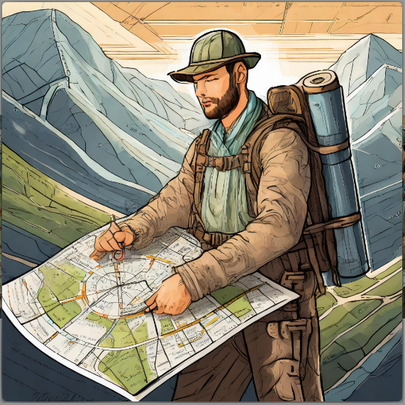


In an era dominated by digital navigation tools, the timeless skills of map reading and compass navigation remain invaluable for outdoor enthusiasts. Whether you’re planning a backpacking trip, hiking in remote areas, or just exploring the great outdoors, a topographic map provides a wealth of information about the terrain, elevations, and crucial details that can make or break your adventure. In this comprehensive guide, we’ll delve into the anatomy of topographic maps, deciphering contour lines, understanding colors, and interpreting legends to equip you with the knowledge needed for successful navigation.
The Importance of Topographic Maps:
While simplified trail maps available online may offer a quick overview, they often lack essential details crucial for navigation. Topographic maps stand out as invaluable tools, providing comprehensive information on elevations, contour lines, vegetation, bodies of water, and more. Unlike electronic devices, topographic maps don’t rely on batteries or cell service, making them reliable backups for navigation.
Anatomy of a Topographic Map:
- Contour Lines:
- Contour lines, thin brown lines on the map, represent points at the same elevation above sea level.
- Understanding contour intervals (usually 40 feet) helps interpret the steepness or gradualness of terrain.
- Contour lines indicate features like steep terrain, ridges, gullies, trails, and cliffs.
- Index and Interval Lines:
- Thick contour lines, called index lines, denote specific elevations.
- Thin, unmarked contour lines between index lines are interval lines, helping calculate elevations.
- Colors on a Topo Map:
- Red: Overprinted on significant roads and U.S. Public Land Survey features.
- Black: Manmade or cultural features.
- Blue: Water-related features.
- Brown: Contour lines and elevation numbers.
- Green: Vegetation features, with darker shades representing denser vegetation.
- White: Sparse or no vegetation.
- Scale:
- The scale indicates the relative distance of the map to real life.
- Understanding scale helps assess the level of detail on the map.
Reading the Legend:
The legend, typically found in the map’s corner, is a key to interpreting symbols and information. It includes details such as source data, scale, contour interval, magnetic declination, color key, symbol key, and more.
Preparing for a Trip with a Topo Map:
- Route Planning:
- Identify trails and roads on the map, noting contour lines and elevation changes.
- Use contour lines to avoid cliffs and assess the steepness of the hike.
- Measure distances using the scale and a string for accuracy.
- Symbol Identification:
- Utilize symbols to identify water sources, potential dangers, and changes in vegetation.
- Optimize campsite selection based on map information.
- Practice Makes Perfect:
- Regularly practice reading and interpreting topo maps to enhance navigation skills.
- Use electronic devices as tools, not crutches, cross-verifying calculations with traditional methods.
Where to Get a Topo Map:
- USGS:
- Download free topographic maps from the United States Geological Survey (USGS).
- Local Government Agencies:
- Check national parks, state parks, and public lands for detailed maps.
- Specialty Companies:
- Explore maps produced by specialty companies, emphasizing specific features.
- Independent Websites:
- Consider reputable websites offering customizable, downloadable topo maps.
Conclusion:
Mastering the art of reading topographic maps is a timeless skill that enhances your outdoor experience and ensures a safe and enjoyable journey. By understanding contour lines, colors, legends, and symbols, you gain a comprehensive knowledge of the terrain, empowering you to navigate confidently in any outdoor setting. Embrace the tradition of map reading, and you’ll not only enhance your trail cred but also cultivate a deeper connection with the landscapes you explore.